
Destinations
Song-Kul, with enough time to understand the place.
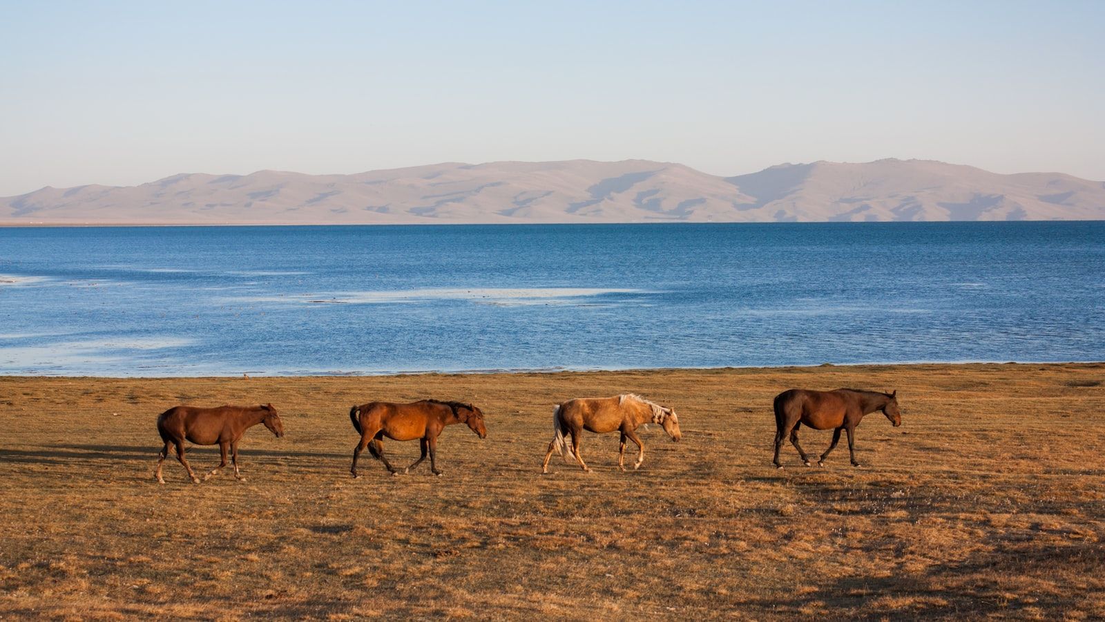
High pasture, yurt camps and horse country at 3,016 m.
Photo by Daniele Nabissi on Unsplash
- Season
- June—September
- Base
- Kochkor, then mountain road
- Pace
- 2—3 days
Go for the place—not only the landmark.
The strongest visit leaves room for local conditions, short walks and the road itself.
- Use one practical base instead of changing hotels every night.
- Match outdoor plans to the season before fixing transfers.
- Leave margin for mountain roads, weather and unplanned stops.
Build a route that still feels like a journey.
Pair nearby places before adding another distant region.
Tash Rabat
A sensible companion when dates and road conditions allow.
Issyk-Kul
A sensible companion when dates and road conditions allow.
Bokonbaevo & south shore
A sensible companion when dates and road conditions allow.
What to decide before you go
Access
Mountain roads take longer than the map suggests; confirm the current approach.
Stay
Choose the base around the next day's activity, not only the best-known town.
Conditions
Weather, road work and seasonal camps can change the final plan.
Song-Kul is the lake Kyrgyzstan’s shepherds claim for themselves each summer. At 3,016 m in Naryn Region, ringed by mountains on every side, it has no permanent buildings at all — no hotels, no shops, no paved road. What it has, from June to September, is the jailoo: high summer pasture covered with horses and sheep, and a scattering of family-run yurt camps where you sleep on quilts under felt, eat what the family eats, and go to bed when the stove burns down. It is the trip most visitors remember longest, and the one that most rewards honest preparation — the cold and the altitude are real, and this page does not pretend otherwise.
What is Song-Kul, and why is it special?
Song-Kul — the name means “Final Lake” — is Kyrgyzstan’s second-largest lake after Issyk-Kul and its largest freshwater lake: about 270 km² of water, up to 29 km long and 13.2 m deep, sitting in a closed basin ringed by mountains of roughly 3,700 m. Because there are no permanent settlements on its shores, the summer landscape belongs to semi-nomadic herder families who bring their animals up from the valleys each June — the jailoo life in its most accessible form. The lake and its shore are protected: Song-Kul was designated a Ramsar Wetland of International Importance in 2011, part of it lies within the Karatal-Japyryk Nature Reserve, and it is a BirdLife Important Bird Area with breeding demoiselle cranes and bar-headed geese. You may see Song-Kul described elsewhere as a UNESCO site — I have found no verification for that claim, so you will not find it here. Ramsar is the real, checkable designation.
When can you actually visit Song-Kul?
The honest window is June to September, with the yurt camps fully running in July and August. Shepherds begin moving their animals back down in mid-September, and by late September the camps are gone and the basin belongs to the wind again. One experienced operator narrows practical access further, to mid-June through early September, and in a heavy-snow year even early June can be too soon — the main pass road is only cleared open by snow-blower at the end of May. In August the jailoo also fills with horse games — our sister site covers the Song-Kul equestrian games each August (in English); dates move, so confirm for the current season.
The season’s end is not a soft guideline. When winter starts, the authorities close the pass road by order: in the 2025 season, the Kalmak-Ashuu road (the Sary-Bulak–Son-Kul section) was officially closed to traffic from 6 November 2025 by the Kochkor district administration because of avalanche risk. Treat that as a 2025-season marker and recheck the current year — the mechanism is the same every winter. Camp set-up and closing dates shift with the season and the weather — I reconfirm them with the camps every year. For how Song-Kul fits the wider calendar, see the best time for each activity.
How do you get to Song-Kul? The four access routes
No public transport reaches the lake. Four passes lead up into the basin, all of them unpaved or partly unpaved, and a 4x4 or high-clearance vehicle is recommended on every one. The standard logistics: Bishkek to Kochkor is about four hours on paved highway; from Kochkor it is roughly 80 km — about two and a half hours of rough dirt road — over Kalmak-Ashuu to the north shore.
| Pass | Elevation | Approach side | Road character |
|---|---|---|---|
| Kalmak-Ashuu | 3,446 m | North, from Kochkor | Unpaved serpentines; fog can cut visibility to near zero; snow possible even in July; 4WD only |
| Moldo-Ashuu | about 3,350 m | South, from the Naryn side | Famous nine-hairpin serpentine above the Kurtka canyon; 4x4 recommended; impassable roughly November–March |
| Kara-Keche | 3,384 m | West, from the Jumgal side | Described as the worst gravel road of the four; 4x4 only |
| Terskey Torpok | 3,132 m | The fourth, lower approach | Unpaved; the least high of the four |
Kalmak-Ashuu (3,446 m) — the standard route from Kochkor
This is how almost everyone arrives: the shortest line from Kochkor to the lake’s north shore. The road climbs in serpentines and the weather changes fast up top — fog can drop visibility almost to nothing, and snow is possible even in July. It is a 4WD road, opened by snow-blower at the end of May and closed again with the first serious winter storm. The photo stop at the pass, with the whole basin suddenly below you, is the arrival moment of the trip.
Moldo-Ashuu — the dramatic southern route from the Naryn side
The southern approach earns its reputation: a nine-hairpin serpentine climbing above the Kurtka river canyon, about 45 km from Kara-Oi up to the lake. Sources conflict on the pass elevation — you will see both about 3,350 m and lower figures around 3,220 m — so I give it cautiously as “about 3,350 m.” Unpaved, 4x4 recommended, and impassable roughly November through March. If you are continuing south toward Tash Rabat or Naryn after the lake, this is the way out that makes the journey a traverse rather than a there-and-back.
Kara-Keche (3,384 m) — the western Jumgal approach
The western way in, from the Jumgal side — and by general agreement the worst gravel road of the four. It goes, and people do it, but it is 4x4-only and slow. It makes sense mainly if your route already has you in Jumgal or you are crossing the country on dirt rather than visiting the lake as a single objective.
Terskey Torpok (3,132 m) — the lower fourth approach
The lowest of the four passes at 3,132 m, and the quietest. Still unpaved, still mountain driving — but a useful option when routing or weather rules out the higher crossings.
Should you go by horse trek or by 4x4?
Both end at the same yurt camps on the same shore — the difference is what the journey gives you. The 4x4 is a half-day transfer from Kochkor: it suits families, shorter trips, and anyone who wants maximum time at the lake with minimum effort. The horse approach makes the arrival itself the experience: two to three days riding in over jailoo passes from Kyzart, sleeping in shepherd yurts on the way. It suits riders and active beginners traveling with a guide — most people who ride in are not experienced horsemen, and the trek is built around that (see horse trekking in Kyrgyzstan for beginners).
| Aspect | 4x4 transfer | Horse trek via Kyzart |
|---|---|---|
| Duration (Kochkor → lake) | ~2.5 h | 2–3 days |
| Effort | None | 5–6 h in the saddle per day |
| Cost shape | Vehicle + driver + camp | Horses, guide, yurt overnights, meals |
| Best for | Families, short trips, non-riders | Riders and active beginners who want the journey |
If you are torn, tell me your dates, your group and your riding experience on WhatsApp — I run a guided horse trek to Song-Kul and also drive the passes in my own 4x4, so I can give you a straight answer either way.
What is the Kyzart–Kilemche horse trek like?
The classic route covers about 30 km over two days. Day one rides roughly 17 km from Kyzart over the Chaar-Archa pass (3,061 m) down to the Kilemche jailoo, where you sleep in a shepherd family’s yurt. Day two is about 13 km over the Jalgyz-Karagai pass at around 3,400 m, then the long descent with the lake opening below you. Three-day versions starting from Kochkor spread the same ground more gently and run in the late-June to mid-September season. There is no trail signage on these routes — you need a GPX track you trust, or a guide who knows the valleys.
What does it cost?
I don’t publish figures here — camp and horse rates at the lake go stale quickly, and I reconfirm them with the camps every season before quoting. The honest shape of the budget: horse rental at the lake is priced per hour or per day; multi-day treks are priced per person per day, all-inclusive; and camp stays fall into tiers, from simple shepherd camps with meals to premium community-tourism camps with full board. Message me with your dates and group size and I’ll come back with current figures, not a stale tariff.
Will I get altitude sickness at Song-Kul?
At 3,016 m, Song-Kul is higher than most North American ski resorts, and mild altitude symptoms on arrival — a headache, poor sleep, breathlessness on stairs that would not normally wind you — are common rather than exceptional. The sensible progression is to sleep your way up: Bishkek at about 750 m, then a night in Kochkor at roughly 1,800 m, then the lake. Take the first afternoon at the shore easy — a short walk, tea, early bed — and most people feel normal by the second morning. The full guidance is on the staying safe at altitude page, including when symptoms mean you should descend.
How cold does it get — even in summer?
Colder than first-time visitors believe. The July mean temperature at the lake is only +11 °C; nights drop to near or below freezing even in midsummer, and inside the yurt you are looking at 0–5 °C once the stove burns out around midnight. Snow can fall on the passes even in July, and afternoon thunderstorms with a 10–15 °C temperature drop are a normal part of a summer day. The wider numbers explain the short season: the basin averages −3.5 °C across the year, snow cover persists 180–200 days annually, and the lake’s winter ice — over a meter thick — only disappears fully by late May.
Pack accordingly: a sleeping bag rated to −5 °C even if the camp provides quilts, full layering, a waterproof shell, and SPF 50+ sun protection — the sun at 3,000 m is as serious as the cold. Bring cash and offline maps: there are no ATMs, no shops and no phone signal at the lake.
What is a yurt-camp stay actually like?
A typical stay runs two to three nights and looks like this (a sample outline — every program is tailored on inquiry). You arrive over the pass around midday to tea and kymyz, take an easy acclimatization walk along the shore, maybe a short introductory ride, then dinner — beshbarmak or shorpo — and a stove-warmed yurt. The following days are rides, hikes, crafts and shore time; the last morning is sunrise and the drive back over the pass, or onward south.
The camp itself: mattresses and thick quilts laid on the floor around the yurt’s perimeter, a wood- or dung-burning stove lit morning and evening, and communal home-cooked meals eaten together — bread still warm, jam, cream, endless tea. Facilities are pit latrines, no running water, little or no electricity (some larger camps run a generator for a few hours each evening), and no wifi or cell signal. None of this is a warning; it is the product. Kyrgyz food is meat-heavy, but vegetarian adaptations — vegetable soups, rice, eggs — are possible with advance notice, so tell me when you book, not when you arrive.
What can you do at the lake?
- Ride. Half- and full-day rides from camp to side valleys and viewpoints, on the shepherds’ own horses.
- Walk the shore. Lakeshore hikes in either direction, with the water changing color by the hour.
- Find the petroglyphs. Carved stones and burial mounds around the lake, especially on the east shore.
- Learn felt-making, or lend a hand with the mare milking — mares are milked five or six times a day through the kymyz season, and guests are welcome to try.
- Watch the sky. At 3,000 m with no light pollution anywhere, the stargazing is exceptional.
- Watch the birds. The lake is a Ramsar wetland and Important Bird Area — demoiselle cranes and bar-headed geese breed here, and birdwatching fits naturally into my eco tours.
Some camps also offer eagle-hunting demonstrations (priced per demonstration where offered — ask me for the current figure). Worth an hour, but know that Bokonbaevo, the home of the bürkütchü, is where that tradition truly lives, and it is worth a dedicated stop on your way to or from the lake.
Can you combine Song-Kul with Tash Rabat or Kel-Suu?
Yes — Song-Kul plus Tash Rabat is the standard Naryn-region pairing, and it is how I most often build this trip: two or three days at the lake, then south via Naryn or Baetov to the 15th-century stone caravanserai. For riders, a horse traverse of roughly 120 km over about three days connects the lake directly to Tash Rabat — an operator-reported route I would call medium confidence until we walk the current season’s options together; the exact routing is confirmed against the current season before we commit. Kel-Suu, the third name usually mentioned in this breath, is covered on the Tash Rabat page — it needs its own permits and planning.
How do I plan my Song-Kul trip?
Start with the season (July–August for certainty), choose horse or 4x4 — or both, riding in and driving out — and give the altitude its first easy afternoon. I drive these passes in my own vehicle and know the camps and the families who run them personally, which matters at a lake where nothing is bookable from a desk. Message me on WhatsApp (the button on this page) or use the contact form with your dates and group size, and I will come back with a route, a camp, and an honest answer on what it costs.
Message us on WhatsApp (opens in new tab)
Contact
Want to see this place with someone who knows the road in? Message Kylych on WhatsApp with your dates and group size, or send the inquiry form — you will hear back with an honest plan, not a package pitch.